Solutions
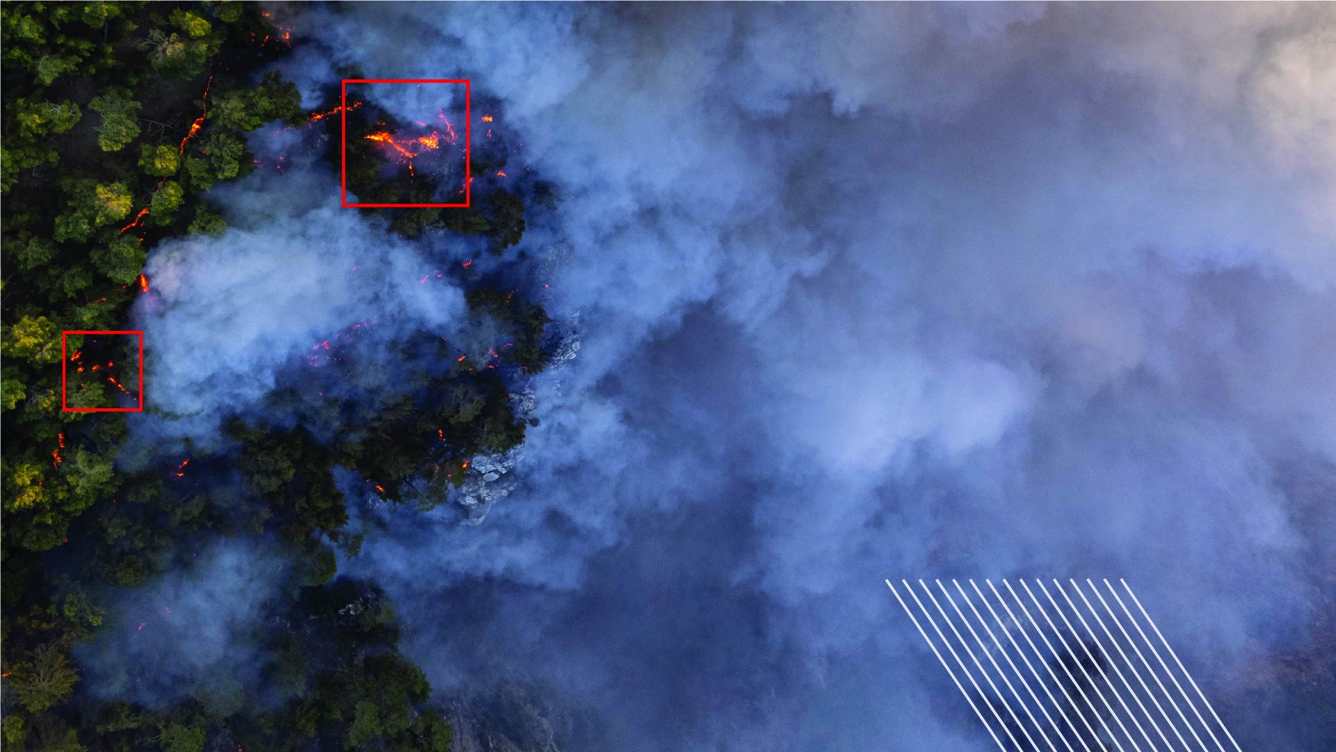
Smart Forest Solution
Detect forest fires by leveraging cutting-edge technology from ideaForge and track their location using FMV solutions in ArcGIS.
Solutions
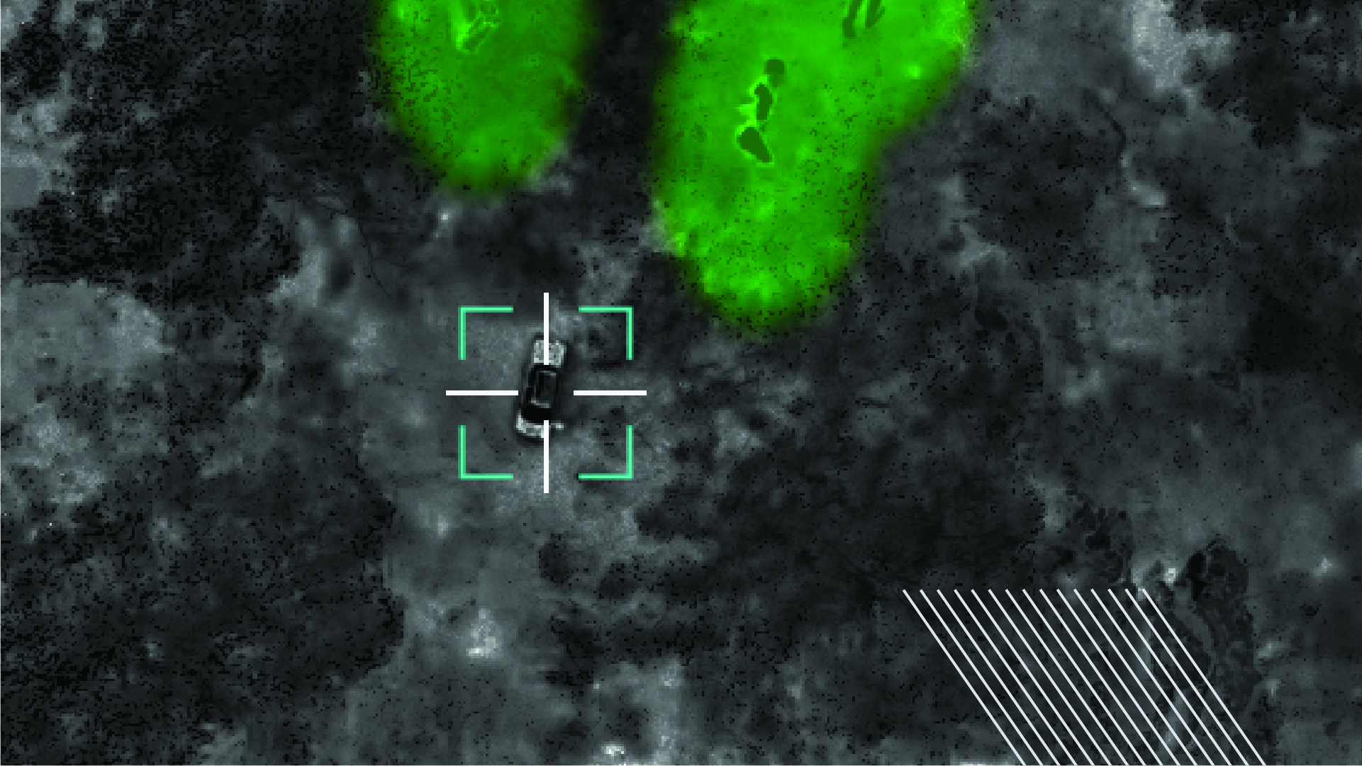
Smart Forest Solution
ideaForge’s Human-only Detection feature ensures forests are safe by accurately identifying human presence, effectively guarding against unauthorised intruders.
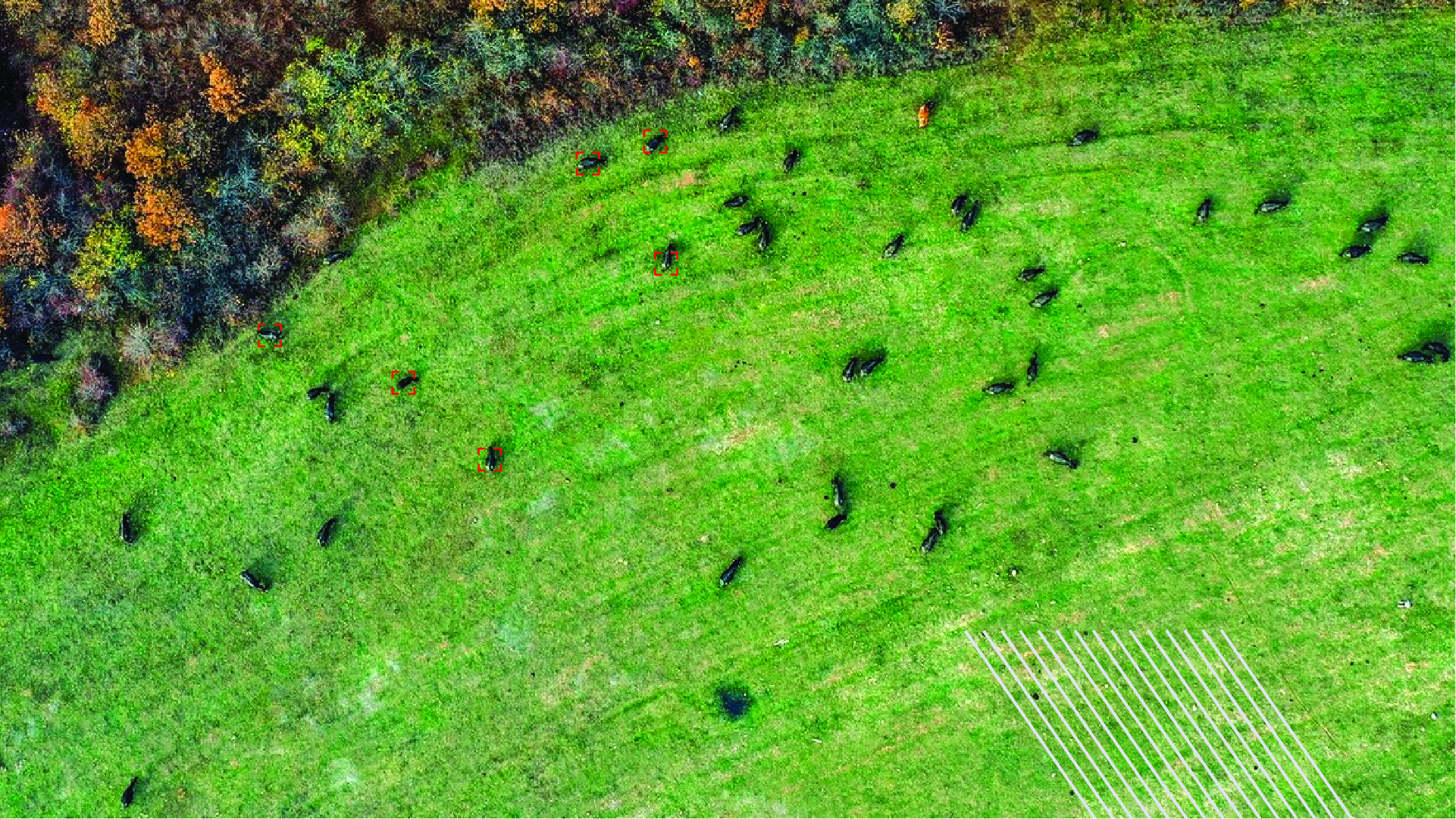
Solutions
Smart Forest Solution
Empower wildlife conservation efforts by seamlessly tracking animal movements using FMV solutions in ArcGIS, thereby optimizing strategies for biodiversity preservation.
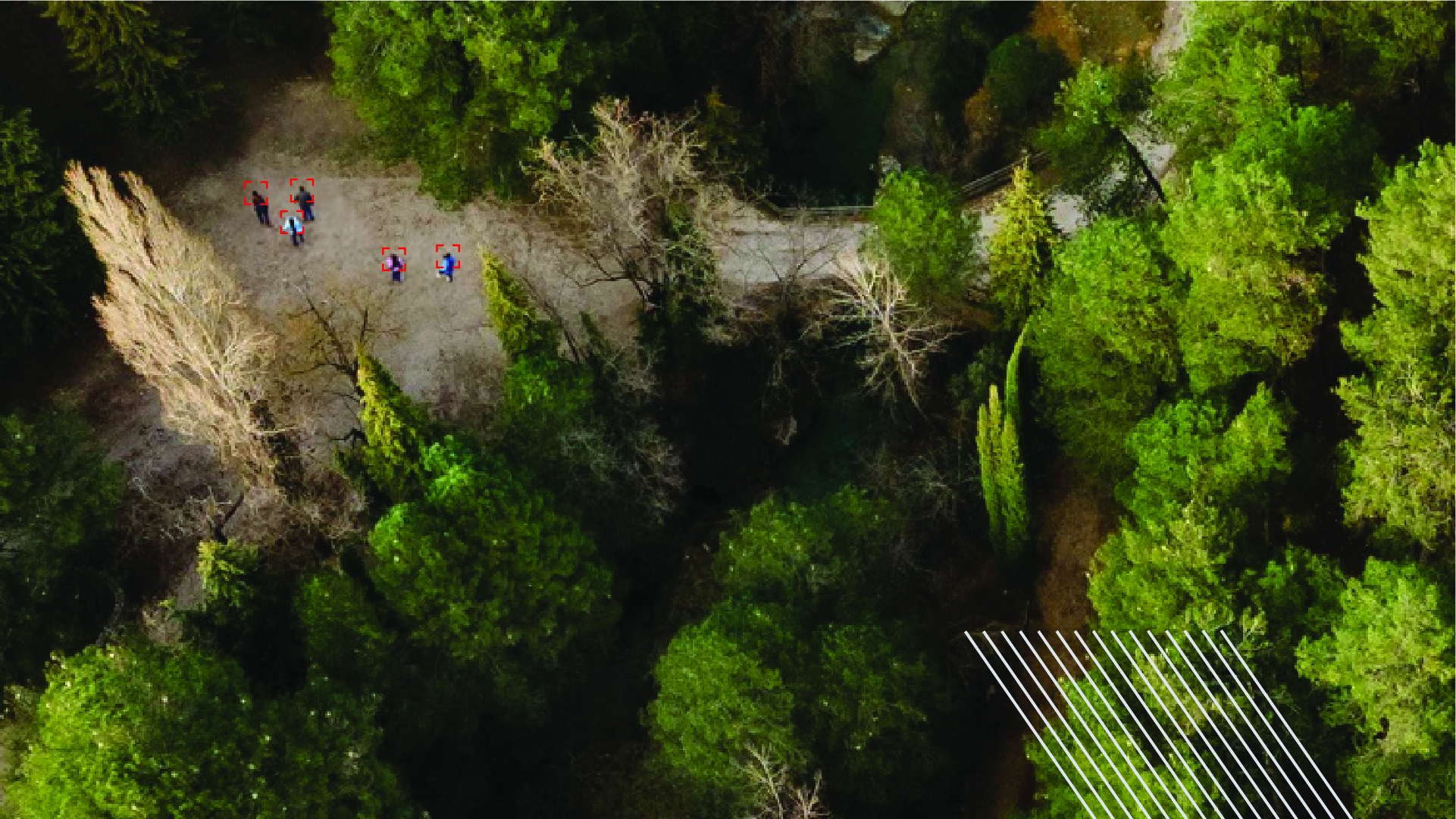
Solutions
Smart Forest Solution
Experience the future of security with our Autonomous Human Detection and Counting Technology, ensuring precise monitoring without manual intervention
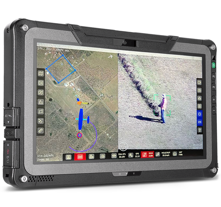
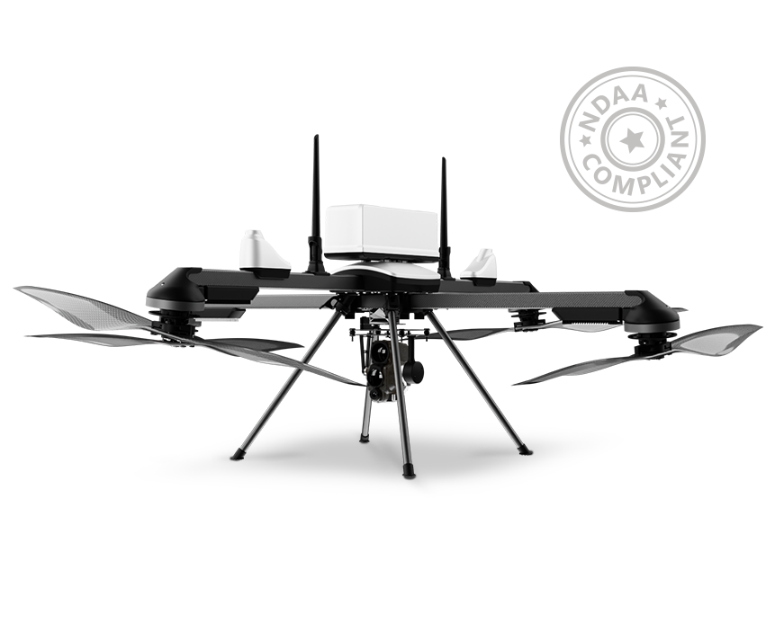
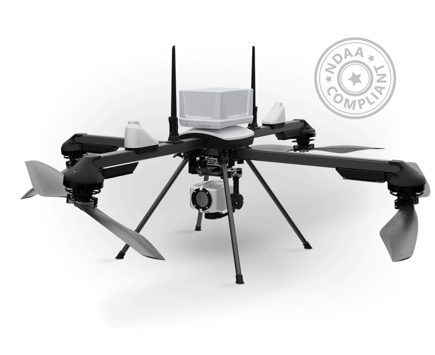
ideaForge UAV Solution
BlueFire Touch
BlueFire Touch, our GCS software, is built to plan and command both mapping and surveillance missions with the ability to pre-plan missions based on operational area and target locations via waypoint-based navigation.
- Joystick-Free Control - Allows you to focus on your mission
- Advanced Mission Planning Features - Check your area coverage and target location area along with a view of the coverage area
- Autonomous Take-off & Landing
- Fail-Safe Features - Communication Loss, Low Battery, High Winds.
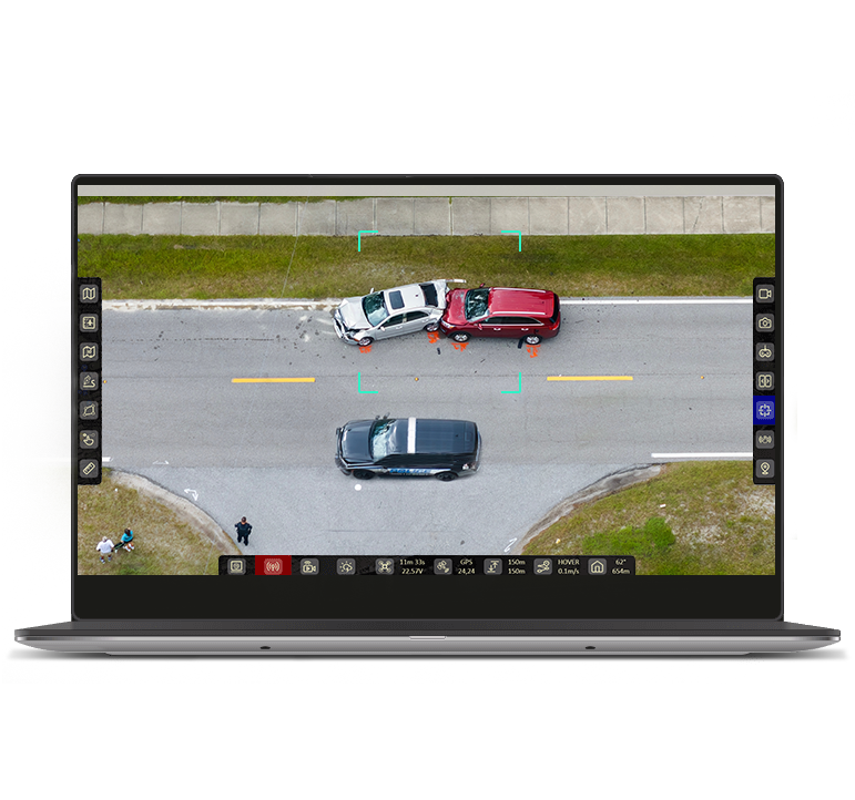
ideaForge UAV Software
BlueFire Live!
- Control payload from a remote command location.
- Secured access to an encrypted live-stream.
- Enhanced night-time operations with thermal imaging.